From Wikipedia, the free encyclopedia
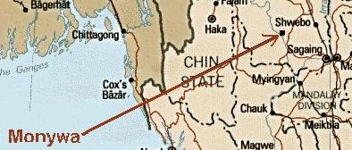
Monywa (Burmese: မုံရြာၿမိဳ႔; MLCTS: muṃ rwa mrui.; Burmese pronunciation: [mòuɴjwà mjo̰]) is a city in Sagaing Division, Myanmar, located 136 km northwest of Mandalay on the eastern bank of the River Chindwin.
Transport

It is served by the Mandalay-Budalin branch railway line, but is best reached by bus as the road from Mandalay is in reasonably good shape. Monywa is now linked by road to Budalin, Dabayin, Ye-U and Kin-U, and by rail to Sagaing and the Mandalay - Myitkyina line.[2] River transport on the Chindwin has always been important as it is navigable for 640 km (400 miles) up to Hkamti during the monsoon season, and most of the year to Homalin.
Economy

Monywa is a major centre for trade and commerce and for agricultural produce from the surrounding Chindwin valley, especially beans, orange, pulses and jaggery (palm sugar). In addition, the local industry includes mills for the production of cotton, flour, noodles, and edible oils. Sausages from Alon called wet udaunk are quite popular, and Budalin longyi (sarong) is known for the strength of the fabric and its checked patterns. Monywa's rough cotton blankets are famous throughout Myanmar, and some can even be found sewn up into knapsacks sold to unsuspecting tourists in Bangkok. Other regional crafts include bamboo and reed products, bullock carts and agricultural implements. The village of Kyaukka is well known for its lacquerware utensils for everyday use.
Black market goods from India, especially saris and bicycle parts, pass through Monywa on their way to other parts of Myanmar.
The major tourist attraction in Monywa (although very few tourists make it there, and facilities are very limited) is Mohnyin Thambuddhei Paya, a Buddhist temple with a huge stupa resembling Indonesia's Borobudur. It dates from 1303, although it was reconstructed in 1939. It is said to contain over 500,000 images of Buddha.
Education
The city is home to:
1. Monywa University
2. Monywa Education College
3. Monywa Institute of Economics
4. Technological University, Monywa and
5. Computer University, Monywa
Politics
The insurgent Burmese Communist Party (BCP) was centred in the Monywa area (west of the Chindwin River) for many years. Although the BCP is no longer active, the Myanmar military presence in Monywa remains heavy.

Sagaing Division
Capital: Sagaing
Hkamti District
Hkamti Township · Homalin Township · Lahe Township · Lay Shi Township (Lashe Township) · Nanyun Township
Sagaingdivisionflag.png
MyanmarSagaing.png
Kale District
Kale Township (Kalemyo Township) · Kalewa Township · Mingin Township
Katha District
Banmauk Township · Indaw Township · Katha Township · Kawlin Township · Pinlebu Township · Tigyaing Township · Wuntho Township
Mawlaik District
Mawlaik Township · Paungbyin Township
Monywa District
Ayadaw Township · Budalin Township · Chaung-U Township · Kani Township · Monywa Township · Pale Township · Salingyi Township · Tabayin Township · Yinmabin Township
Sagaing District
Myaung Township · Myinmu Township · Sagaing Township
Shwebo District
Kanbalu Township · Khin-U Township · Kyunhla Township · Shwebo Township · Taze Township · Wetlet Township · Ye-U Township
Tamu District
Tamu Township
Main cities and towns
Sagaing · Myinmu · Myaung · Shwebo · Kin-U · Wetlet · Kanbalu · Kyunhla · Ye-U · Tavbayin
· Taze · Monywa · Budlin · Ayadaw · Chaung-U · Yinmabin · Kani · Salingyi · Pale · Katha · Indaw · Htigyaing · Bamauk · Kawlin · Wuntho · Pinlebu · Kale · Kalewa · Mingin · Tamu · Mawlaik · Mingun · Pahungpoyin · Hkamti · Homalin · Leshi · Lahe · Nanyun
Sagaing Division
Sagaing Division (Burmese: စစ်ကိုင်းတိုင်း, pronounced [zəgáiɴ táiɴ]) is an administrative division of Myanmar, located in the north-western part of the country between latitude 21° 30' north and longitude 94° 97' east. It is bordered by India’s Nagaland and Manipur States to the north, Kachin State, Shan State, and Mandalay Division to the east, Mandalay Division and Magway Division to the south, with the Ayeyarwady River forming a greater part of its eastern and also southern boundary, and Chin State and India to the west. The division has an area of 93,527 km², and population (1996) of over 5,300,000. The capital is Sagaing.
History
The Pyu were the first to in recorded history to populate the area of Sagaing Division by the 1st century CE. The Burmans first migrated into Upper Myanmar by 9th century CE. The area came under the Pagan Kingdom certainly by the middle of 11th century when King Anawrahta (r. 1044-1077) founded the Pagan Empire, which encompasses the modern day Myanmar.
After the fall of Pagan in 1287, the northwestern parts of Upper Myanmar came under the Sagaing Kingdom (1315-1364) ruled by Burmanized Shan kings. The area was ruled by the kings of Ava from 1364 to 1555 and the kings of Taungoo from 1555 to 1752. Konbaung Dynasty (1752-1885), founded by king Alaungpaya in Shwebo, became the last Burmese dynasty before the British conquest of Upper Burma in 1885. The area became Sagaing Division after the Burmese independence in January 1948.
Administration
Sagaing Division consists of eight districts divided into 37 townships with 198 wards and villages. The major cities are Sagaing, Monywa, Shwebo, Katha, Kale, Tamu, Mawlaik and Hkamti. Mingun with its famous bell is located near Sagaing but can be reached across the Ayeyarwady from Mandalay. The districts are Sagaing, Shwebo, Monywa, Katha, Kale (Kalemyo), Tamu, Mawlaik and Hkamti. The townships are:
* Ayadaw
* Banmauk
* Budalin
* Chaung-U
* Hkamti
* Homalin
* Indaw
* Kale
* Kalewa
* Kanbalu
* Kani
* Katha
* Kawlin
* Khin-U
* Kyunhla
* Lahe
* Lay Shi
* Mawlaik
* Mingin
* Monywa
* Myaung
* Myinmu
* Nanyun
* Pale
* Paungbyin
* Pinlebu
* Sagaing
* Salingyi
* Shwebo
* Tabayin
* Tamu
* Taze
* Tigyaing
* Wetlet
* Wuntho
* Ye-U
* Yinmabin (Yin Mar Bin)
Demographics
The Bamar (Burmans) are the majority ethnic group in the dry regions and along the Mandalay-Myitkyina Railroad. Shan live in the upper Chindwin River valley. A sizable minority of Naga resides in the north of north-west mountain ranges and Chin in the south. Smaller ethnic groups native to the Division include the Kadu and Ganang, who live in the upper Mu River valley and Meza River valley.
Ecology
There are a number of protected areas in Sagaing Division, among them are Alaungdaw Kathapa National Park, Chatthin Wildlife Sanctuary,Mahamyaing Wildlife Sanctuary,and Htamanthi Wildlife Sanctuary in Homalin Township.
Transport

Hemmed in by two great rivers of Myanmar, the Ayeyarwady and the Chindwin, river transport is a common way to move people and cargo. Much of the inland Sagaing Division relies on roads and rail in poor condition.
Economy
Agriculture is the chief occupation. The leading crop is rice, which occupies most of the arable ground. Other crops include wheat, sesame, peanut, pulses, cotton, and tobacco. Sagaing is Myanmar’s leading producer of wheat, contributing more than 80% of the country's total production. Forestry is important in the wetter upper regions along the Chindwin River, with teak and other hardwoods extracted. As in other parts of the country, reforestation is not effective enough to maintain sustainable forestry. Important minerals include gold, coal, salt and small amounts of petroleum. Industry includes textiles, copper refining, gold smelting, and a diesel engine plant. The Division has many rice mills, edible oil mills, saw mills, cotton mills, and mechanized weaving factories. Local industry includes earthen pots, silverware, bronze-wares, iron-wares and lacquerware.
Education
* Computer University, Monywa
* Government Technical College, Shwebo
* Government Technical College, Sagaing
* Monywa Education College
* Monywa Institute of Economics
* Monywa University
* Shwebo Degree College
* Sagaing Institute of Education
* Sagaing Regional Co-operative College
* Technological University, Monywa
* University for Development of National Races
Educational opportunities in Myanmar are extremely limited outside the main cities of Yangon and Mandalay. According to official statistics, less than 10% of primary school students in Sagaing Division reach high school.
AY 2002-2003
Primary Schools-(3854)/Teachers-(16,100)/Students-(550,000)
Middle Schools-(190)/Teachers-(5,000)/Students-(140,000)
High Schools-(84)/Teachers-(1,600)/Students-(49,000)
Health care
The general state of health care in Myanmar is poor. The military government spends anywhere from 0.5% to 3% of the country's GDP on health care, consistently ranking among the lowest in the world. Although health care is nominally free, in reality, patients have to pay for medicine and treatment, even in public clinics and hospitals. Public hospitals lack many of the basic facilities and equipment. Moreover, the health care infrastructure outside of Yangon and Mandalay is extremely poor. In 2003, Sagaing Division had less than a quarter of hospital beds than Yangon Division with a similar size of population.
The End.
Thank to U Thaung Nyunt (Monywa) May-2003
by Htay Htay Myint
No comments:
Post a Comment